Articles | Volume 1, issue 1
https://doi.org/10.5194/eo-1-129-2026
© Author(s) 2026. This work is distributed under
the Creative Commons Attribution 4.0 License.
https://doi.org/10.5194/eo-1-129-2026
© Author(s) 2026. This work is distributed under
the Creative Commons Attribution 4.0 License.
Pan-Antarctic evaluation of National Snow and Ice Data Center (NSIDC) sea ice drift product using high-resolution SAR and buoy data

National Snow and Ice Data Center (NSIDC), Cooperative Institute for Research in Environmental Sciences (CIRES), University of Colorado Boulder, UCB 449, Boulder, CO 80309, USA
Walter N. Meier
National Snow and Ice Data Center (NSIDC), Cooperative Institute for Research in Environmental Sciences (CIRES), University of Colorado Boulder, UCB 449, Boulder, CO 80309, USA
J. Scott Stewart
National Snow and Ice Data Center (NSIDC), Cooperative Institute for Research in Environmental Sciences (CIRES), University of Colorado Boulder, UCB 449, Boulder, CO 80309, USA
Related authors
Younghyun Koo, Gong Cheng, Mathieu Morlighem, and Maryam Rahnemoonfar
The Cryosphere, 19, 2583–2599, https://doi.org/10.5194/tc-19-2583-2025, https://doi.org/10.5194/tc-19-2583-2025, 2025
Short summary
Short summary
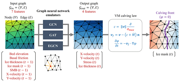
Calving, the breaking of ice bodies from the terminus of a glacier, plays an important role in the mass losses of Greenland ice sheets. However, calving parameters have been poorly understood because of the intensive computational demands of traditional numerical models. To address this issue and find the optimal calving parameter that best represents real observations, we develop deep-learning emulators based on graph neural network architectures.
Mukund Gupta, Heather Regan, Younghyun Koo, Sean Minhui Tashi Chua, Xueke Li, and Petra Heil
The Cryosphere, 19, 1241–1257, https://doi.org/10.5194/tc-19-1241-2025, https://doi.org/10.5194/tc-19-1241-2025, 2025
Short summary
Short summary
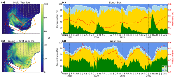
The sea ice cover is composed of floes, whose shapes set the material properties of the pack. Here, we use a satellite product (ICESat-2) to investigate these floe shapes within the Weddell Sea in Antarctica. We find that floes tend to become smaller during the melt season, while their thickness distribution exhibits different behavior between the western and southern regions of the pack. These metrics will help calibrate models and improve our understanding of sea ice physics across scales.
YoungHyun Koo, Hongjie Xie, Stephen F. Ackley, Alberto M. Mestas-Nuñez, Grant J. Macdonald, and Chang-Uk Hyun
The Cryosphere, 15, 4727–4744, https://doi.org/10.5194/tc-15-4727-2021, https://doi.org/10.5194/tc-15-4727-2021, 2021
Short summary
Short summary
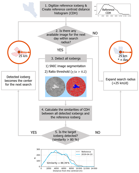
This study demonstrates for the first time the potential of Google Earth Engine (GEE) cloud-computing platform and Sentinel-1 synthetic aperture radar (SAR) images for semi-automated tracking of area changes and movements of iceberg B43. Our novel GEE-based iceberg tracking can be used to construct a large iceberg database for a better understanding of the behavior of icebergs and their interactions with surrounding environments.
Younghyun Koo, Gong Cheng, Mathieu Morlighem, and Maryam Rahnemoonfar
The Cryosphere, 19, 2583–2599, https://doi.org/10.5194/tc-19-2583-2025, https://doi.org/10.5194/tc-19-2583-2025, 2025
Short summary
Short summary
Calving, the breaking of ice bodies from the terminus of a glacier, plays an important role in the mass losses of Greenland ice sheets. However, calving parameters have been poorly understood because of the intensive computational demands of traditional numerical models. To address this issue and find the optimal calving parameter that best represents real observations, we develop deep-learning emulators based on graph neural network architectures.
Mukund Gupta, Heather Regan, Younghyun Koo, Sean Minhui Tashi Chua, Xueke Li, and Petra Heil
The Cryosphere, 19, 1241–1257, https://doi.org/10.5194/tc-19-1241-2025, https://doi.org/10.5194/tc-19-1241-2025, 2025
Short summary
Short summary
The sea ice cover is composed of floes, whose shapes set the material properties of the pack. Here, we use a satellite product (ICESat-2) to investigate these floe shapes within the Weddell Sea in Antarctica. We find that floes tend to become smaller during the melt season, while their thickness distribution exhibits different behavior between the western and southern regions of the pack. These metrics will help calibrate models and improve our understanding of sea ice physics across scales.
YoungHyun Koo, Hongjie Xie, Stephen F. Ackley, Alberto M. Mestas-Nuñez, Grant J. Macdonald, and Chang-Uk Hyun
The Cryosphere, 15, 4727–4744, https://doi.org/10.5194/tc-15-4727-2021, https://doi.org/10.5194/tc-15-4727-2021, 2021
Short summary
Short summary
This study demonstrates for the first time the potential of Google Earth Engine (GEE) cloud-computing platform and Sentinel-1 synthetic aperture radar (SAR) images for semi-automated tracking of area changes and movements of iceberg B43. Our novel GEE-based iceberg tracking can be used to construct a large iceberg database for a better understanding of the behavior of icebergs and their interactions with surrounding environments.
Cited articles
Emery, W. J., Fowler, C. W., Hawkins, J., and Preller, R. H.: Fram Strait satellite image-derived ice motions, J. Geophys. Res.-Oceans, 96, 4751–4768, https://doi.org/10.1029/90JC02273, 1991. a
Emery, W. J., Fowler, C., and Maslanik, J.: Satellite remote sensing of ice motion, in: Oceanographic Applications of Remote Sensing, edited by: Motoyoshi, I. and Dobson, F., CRC Press, ISBN 0849345251, 1995. a
Gorelick, N., Hancher, M., Dixon, M., Ilyushchenko, S., Thau, D., and Moore, R.: Google Earth Engine: Planetary-scale geospatial analysis for everyone, Remote Sens. Environ., 202, 18–27, https://doi.org/10.1016/j.rse.2017.06.031, 2017. a
Gui, D., Lei, R., Pang, X., Hutchings, J. K., Zuo, G., and Zhai, M.: Validation of remote-sensing products of sea-ice motion: a case study in the western Arctic Ocean, J. Glaciol., 66, 807–821, https://doi.org/10.1017/jog.2020.49, 2020. a
Hamming, R. W.: Error detecting and error correcting codes, Bell Syst. Tech. J., 29, 147–160, https://doi.org/10.1002/j.1538-7305.1950.tb00463.x, 1950. a
Heil, P., Fowler, C., Maslanik, J. A., Emery, W. J., and Allison, I.: A comparison of East Antarctic sea-ice motion derived using drifting buoys and remote sensing, Ann. Glaciol., 33, 139–144, https://doi.org/10.3189/172756401781818374, 2001. a
Heil, P., Fowler, C., and Lake, S.: Antarctic Sea-ice velocity as derived from SSM/I imagery, Ann. Glaciol., 44, 361–366, https://doi.org/10.3189/172756406781811682, 2006. a
Holland, P. R. and Kwok, R.: Wind-driven trends in Antarctic sea-ice drift, Nat. Geosci., 5, 872–875, https://doi.org/10.1038/ngeo1627, 2012. a
Howell, S. E. L., Brady, M., and Komarov, A. S.: Generating large-scale sea ice motion from Sentinel-1 and the RADARSAT Constellation Mission using the Environment and Climate Change Canada automated sea ice tracking system, The Cryosphere, 16, 1125–1139, https://doi.org/10.5194/tc-16-1125-2022, 2022. a
Hwang, B.: Inter-comparison of satellite sea ice motion with drifting buoy data, Int. J. Remote Sens., 34, 8741–8763, https://doi.org/10.1080/01431161.2013.848309, 2013. a
Kimura, N.: Sea Ice Motion in Response to Surface Wind and Ocean Current in the Southern Ocean, J. Meteorol. Soc. Jpn., 82, 1223–1231, https://doi.org/10.2151/jmsj.2004.1223, 2004. a, b
Koo, Y.: SAR-derived Antarctic sea ice velocity (2015–2023) (Version v2), Zenodo [data set], https://doi.org/10.5281/zenodo.22942305, 2026a. a
Koo, Y.: YoungHyunKoo/sea_ice_drift: Version 1 (Version v1), Zenodo [code], https://doi.org/10.5281/zenodo.22792788, 2026b. a
Koo, Y., Xie, H., Ackley, S. F., Mestas-Nuñez, A. M., Macdonald, G. J., and Hyun, C.-U.: Semi-automated tracking of iceberg B43 using Sentinel-1 SAR images via Google Earth Engine, The Cryosphere, 15, 4727–4744, https://doi.org/10.5194/tc-15-4727-2021, 2021. a
Koo, Y., Xie, H., Mahmoud, H., Iqrah, J. M., and Ackley, S. F.: Automated detection and tracking of medium-large icebergs from Sentinel-1 imagery using Google Earth Engine, Remote Sens. Environ., 296, 113731, https://doi.org/10.1016/j.rse.2023.113731, 2023. a
Korosov, A.: nansencenter/sea_ice_drift: SeaIceDrift-0.7 (Version v0.7), Zenodo [code], https://doi.org/10.5281/zenodo.1446409, 2018. a
Kwok, R.: Ross Sea Ice Motion, Area Flux, and Deformation, J. Climate, 18, 3759–3776, https://doi.org/10.1175/JCLI3507.1, 2005. a
Kwok, R.: Satellite remote sensing of sea-ice thickness and kinematics: a review, J. Glaciol., 56, 1129–1140, https://doi.org/10.3189/002214311796406167, 2010. a, b
Kwok, R., Schweiger, A., Rothrock, D. A., Pang, S., and Kottmeier, C.: Sea ice motion from satellite passive microwave imagery assessed with ERS SAR and buoy motions, J. Geophys. Res.-Oceans, 103, 8191–8214, https://doi.org/10.1029/97JC03334, 1998. a, b, c
Lavergne, T. and Down, E.: Validation and Monitoring of the OSI SAF Low Resolution Sea Ice Drift Product (Version 6), Tech. rep., EUMETSAT OSI SAF, https://doi.org/10.15770/EUM_SAF_OSI_NRT_2007, 2024. a
Lavergne, T. and Down, E. J.: Validation Report for the Global Sea Ice Drift Climate Data Record v1 (OSI-455), Tech. rep., Norwegian Meteorological Institute, https://doi.org/10.15770/EUM_SAF_OSI_0012, 2022. a
Lavergne, T., Eastwood, S., Teffah, Z., Schyberg, H., and Breivik, L.-A.: Sea ice motion from low-resolution satellite sensors: An alternative method and its validation in the Arctic, J. Geophys. Res.-Oceans, 115, 1–14, https://doi.org/10.1029/2009JC005958, 2010. a, b
Lowe, D.: Distinctive Image Features from Scale-Invariant Keypoints, Int. J. Comput. Vision, 60, 91–110, https://doi.org/10.1023/B:VISI.0000029664.99615.94, 2004. a
Muckenhuber, S. and Sandven, S.: Open-source sea ice drift algorithm for Sentinel-1 SAR imagery using a combination of feature tracking and pattern matching, The Cryosphere, 11, 1835–1850, https://doi.org/10.5194/tc-11-1835-2017, 2017. a, b, c
Muckenhuber, S., Korosov, A. A., and Sandven, S.: Open-source feature-tracking algorithm for sea ice drift retrieval from Sentinel-1 SAR imagery, The Cryosphere, 10, 913–925, https://doi.org/10.5194/tc-10-913-2016, 2016. a, b
Park, J.-W., Kim, H.-C., Korosov, A., Demchev, D., Zecchetto, S., Kim, S. H., Kwon, Y.-J., Han, H., and Hyun, C.-U.: Feasibility Study on Estimation of Sea Ice Drift from KOMPSAT-5 and COSMO-SkyMed SAR Images, Remote Sens., 13, https://doi.org/10.3390/rs13204038, 2021. a
Purich, A. and Doddridge, E. W.: Record low Antarctic sea ice coverage indicates a new sea ice state, Commun. Earth Environ., 4, 314, https://doi.org/10.1038/s43247-023-00961-9, 2023. a, b
Raphael, M. N. and Handcock, M. S.: A new record minimum for Antarctic sea ice, Nat. Rev. Earth Environ., 3, 215–216, https://doi.org/10.1038/s43017-022-00281-0, 2022. a
Rozman, P., Hölemann, J. A., Krumpen, T., Gerdes, R., Köberle, C., Lavergne, T., Adams, S., and Girard-Ardhuin, F.: Validating satellite derived and modelled sea-ice drift in the Laptev Sea with in situ measurements from the winter of 2007/2008, Polar Res., 30, 7218, https://doi.org/10.3402/polar.v30i0.7218, 2011. a
Schwegmann, S., Haas, C., Fowler, C., and Gerdes, R.: A comparison of satellite-derived sea-ice motion with drifting-buoy data in the Weddell Sea, Antarctica, Ann. Glaciol., 52, 103–110, https://doi.org/10.3189/172756411795931813, 2011. a, b
Sumata, H., Lavergne, T., Girard-Ardhuin, F., Kimura, N., Tschudi, M. A., Kauker, F., Karcher, M., and Gerdes, R.: An intercomparison of Arctic ice drift products to deduce uncertainty estimates, J. Geophys. Res.-Oceans, 119, 4887–4921, https://doi.org/10.1002/2013JC009724, 2014. a
Tian, T. R., Fraser, A. D., Kimura, N., Zhao, C., and Heil, P.: Rectification and validation of a daily satellite-derived Antarctic sea ice velocity product, The Cryosphere, 16, 1299–1314, https://doi.org/10.5194/tc-16-1299-2022, 2022. a
Torres, R., Snoeij, P., Geudtner, D., Bibby, D., Davidson, M., Attema, E., Potin, P., Rommen, B., Floury, N., Brown, M., Traver, I. N., Deghaye, P., Duesmann, B., Rosich, B., Miranda, N., Bruno, C., L'Abbate, M., Croci, R., Pietropaolo, A., Huchler, M., and Rostan, F.: GMES Sentinel-1 mission, Remote Sens. Environ., 120, 9–24, https://doi.org/10.1016/j.rse.2011.05.028, 2012. a
Tschudi, M., Meier, W. N., Stewart, J. S., Fowler, C., and Maslanik, J.: Polar Pathfinder Daily 25 km EASE-Grid Sea Ice Motion Vectors (NSIDC-0116, Version 4), NASA National Snow and Ice Data Center Distributed Active Archive Center, Boulder, Colorado USA [data set], https://doi.org/10.5067/INAWUWO7QH7B, 2019. a, b, c, d, e, f, g, h, i
Turner, J., Holmes, C., Caton Harrison, T., Phillips, T., Jena, B., Reeves-Francois, T., Fogt, R., Thomas, E. R., and Bajish, C.: Record low Antarctic sea ice cover in February 2022, Geophys. Res. Lett., 49, e2022GL098904, https://doi.org/10.1029/2022GL098904, 2022. a
Wang, J., Massonnet, F., Goosse, H., Luo, H., Barthélemy, A., and Yang, Q.: Synergistic atmosphere-ocean-ice influences have driven the 2023 all-time Antarctic sea-ice record low, Commun. Earth Environ., 5, 415, https://doi.org/10.1038/s43247-024-01523-3, 2024. a
Wu, Q.: geemap: A Python package for interactive mapping with Google Earth Engine, Journal of Open Source Software, 5, 2305, https://doi.org/10.21105/joss.02305, 2020. a
Short summary
Passive microwave (PMW) satellite data have been widely used to monitor Antarctic sea ice velocity (SIV) on a pan-Antarctic scale. We present a comprehensive evaluation of a PMW-derived Antarctic SIV by leveraging high-resolution SIV fields derived from synthetic aperture radar imagery. We found a widespread ~ 1 km d−1 underestimation of ice drift speed across the Southern Ocean, caused by optimal interpolation.
Passive microwave (PMW) satellite data have been widely used to monitor Antarctic sea ice...